
The Geo Data Merger is a desktop open source tool for merging data from csv, json, geo- and topojson files.
Geo Data Merger is a lightweight, open-source desktop tool designed to simplify the process of combining multiple datasets. Developed by Funke Interaktiv and webkid, it focuses on ease of use and local data processing.
The main features of this tool include:
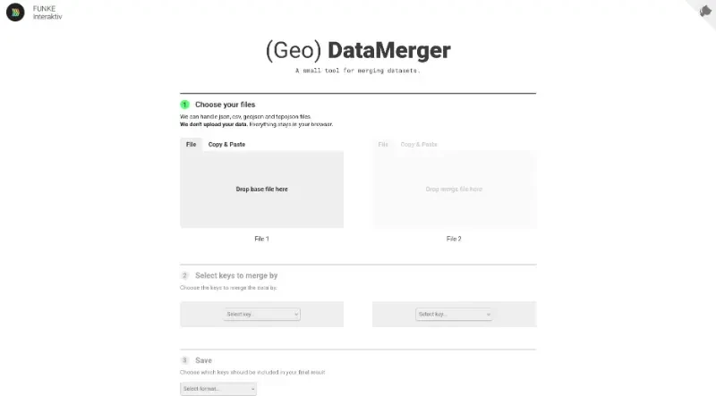
Versatile File Support: The tool can handle a variety of common data formats, including JSON, CSV, GeoJSON, and TopoJSON.
Browser-Based Privacy: A critical feature is that data is never uploaded to a server; all processing happens locally within your browser, ensuring your information remains private.
Flexible Input Methods: Users can provide data by either uploading files directly or using a simple copy-and-paste method.
Intuitive Merge Workflow: The tool follows a clear three-step process: choosing files, selecting the specific keys to merge by, and finally deciding which data keys to include in the final output.
Customizable Results: Before saving, users can filter the data to include only the necessary information and choose their preferred output format.
Open-Source Transparency: As an open-source project, it allows for community review and is provided as a free resource for the data community.

You may also be interested in ...

Table Convert

Qwik