

The openrouteservice API consumes user-generated and collaboratively collected free geographic data, directly from OpenStreetMap.
Openrouteservice (ORS), provides a variety of Geo-services via a single, free, and open source API designed for smart mobility. ORS consumes geographic data that is user-generated and collaboratively collected directly from OpenStreetMap (OSM).
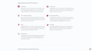
The key functionalities and services of openrouteservice are organized into several core API services and specialized planning tools:
Core API Services
The API provides interactive documentation for a wide range of services:
Directions: This service offers rich route instructions globally. It supports various profiles including cars, trucks, different bike profiles, walking, hiking, or wheelchair. Routes can be customized using options such as road restrictions and vehicle dimensions.
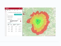
Isochrones: Used for reachability analysis, this service helps determine which areas objects can reach within given times or distances. Users can request up to 500 Isochrones per day for free.
Time-Distance Matrix: This feature calculates many-to-many distances and route times much faster than repeated consumption of the directions API. It is frequently utilized by logistics organizations seeking optimal delivery routes.
Pelias Geocoding: Transforms location descriptions (e.g., place names, street addresses, postal codes) into a normalized location with point geometry. This service is built on top of the sophisticated Pelias Stack.
POIs (Points of Interest): Known as Openpoiservice, it allows users to find categories of points of interest around or within given geographic coordinates. Searches can be executed along a point, path, or within a polygon.
Elevation (Openelevationservice): Easily enriches 2D geometries with height information based on SRTM data, returning the 3D version within milliseconds.
Optimization: Addresses complex planning problems like the Traveling Salesmen and other Vehicle Routing Problems. Based on the Vroom project, it provides optimal routes while considering specific vehicle and time constraints.
Planning Tools and Clients
openrouteservice provides several planning clients tailored for different user needs:
Classic Maps Client: This route planning tool enables users to access most of the openrouteservice API functionalities. Users can choose from a variety of profiles, set up to 50 waypoints, and customize routes by avoiding specific areas, street types, or whole countries. It also allows querying POIs along routes and performing accessibility analyses.
New Maps Client: Built using the VueJs framework, this client is responsive and optimized for both mobile and desktop browsers. It retains all functionalities of the previous client and aims to simplify route planning. The new approach also makes it possible to convert the client to a native mobile app.
Disaster Maps Client: Developed specifically to support humanitarian actors and disaster responders. In disaster situations, the service is limited to active disaster regions, allowing the routing graph to be recalculated every hour based on current OSM data. This capability is part of the expanded Disaster Management functionalities offered by ORS.
Technical and Development Aspects
Open Source and Data: The code for openrouteservice is entirely opensource and freely available on GitHub. It is humanitarian focused, constantly developing services to meet current needs in disaster prevention and relief.
SDK Support: Using the API is simplified through available SDKs for Python, R, JavaScript, and QGIS.
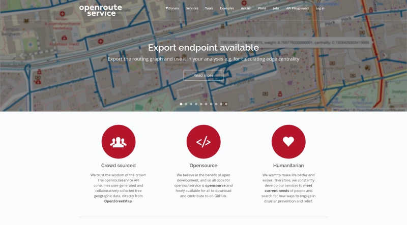
Export Endpoint: Users can export the routing graph for use in external analyses, such as calculating edge centrality.
Version 8.0 Enhancements: Recent updates include a low RAM option, a new Docker Compose setup, overhauled configuration, improved logging, new backend documentation, and the ability to run the service as a JAR.
You may also be interested in ...

Tailwind CSS 3.0

UnoCSS